Methodology
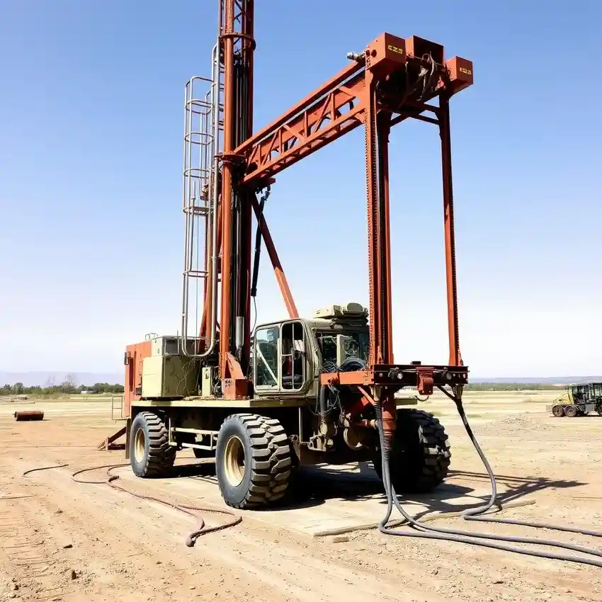
Our approach in Peoria begins with a thorough assessment of the local hydrogeology, focusing on the alluvial deposits of the Salt River Valley. We analyze existing well logs and geologic maps to understand subsurface layering before mobilizing equipment. The drilling process is tailored to the encountered sediments, often transitioning from unconsolidated sands and gravels to denser caliche layers. Proper well development is paramount to ensure optimal yield and longevity, which is why we employ industry-best practices for water well drilling in this specific environment.
Reference Technical Parameters
| Parameter | Reference Value |
|---|---|
| Predominant Soil Type | Alluvial Sands, Gravels, and Caliche |
| Typical Groundwater Level | 100 - 300 ft below ground surface |
| Typical Bedrock Depth | Greater than 500 ft (Basin and Range basement) |
| Maximum Seismic Acceleration (PGA) | 0.2g - 0.3g (Site Class D) |
| Aquifer System | Salt River Valley Alluvial Aquifer |
Local Considerations — Peoria Arizona
Peoria's geology presents distinct considerations for well development. First, the water table depth is highly variable, generally ranging from 100 to 300 feet, influenced by proximity to the Agua Fria River and historical recharge. Second, the presence of a thick, cemented caliche layer often acts as a semi-confining unit, affecting drilling rates and well screen placement. Third, while seismic risk is moderate, soil liquefaction potential in saturated, loose alluvial sands must be evaluated for pump house foundations. Fourth, well yields can differ significantly between the older, central areas and newer northwestern expansions due to varying aquifer thickness. Finally, adherence to the Peoria City Code and North American Subtitle D regulations for drilling waste is mandatory to prevent groundwater contamination, underscoring the need for a professional hydrogeological survey prior to any drilling program. For major regional projects, our centralized team provides extensive support for water well drilling from our Phoenix operations.
Request a Quote
Our team reviews your project and issues an initial report at no cost.
Or write us directly at [email protected]
Services in Peoria Arizona
Applicable Standards
- Arizona Department of Water Resources (ADWR) Well Construction Standards
- Arizona Administrative Code (AAC) R12-15-901 et seq.
- Peoria City Code, Chapter 17 - Water
- North American Subtitle D Regulations
Frequently Asked Questions
What soil conditions are most challenging for water well drilling in Peoria?
The cemented caliche layers, often several feet thick, present the most significant challenge. They require specialized drilling bits and can slow progress considerably. Additionally, encountering loose, running sands requires careful use of drilling fluid and casing to prevent borehole collapse before the well screen is installed.
How does Peoria's location in an Active Management Area (AMA) affect well permitting?
The Salt River Valley AMA imposes strict regulations on new groundwater withdrawals. Permitting through the ADWR is mandatory, and demonstrating legal groundwater rights or applying for a Type 2 Non-Irrigation Grandfathered Right is a complex prerequisite. All wells must be metered, and annual water use reports are required.
Is a hydrogeological study always required before drilling a well in Peoria?
While not always legally mandated for every single-family residential well, it is a critical best practice. Given the variable aquifer conditions and the high cost of drilling a non-productive or poorly constructed well, a professional study to determine optimal depth, screen placement, and sustainable yield is a highly recommended investment.