Methodology
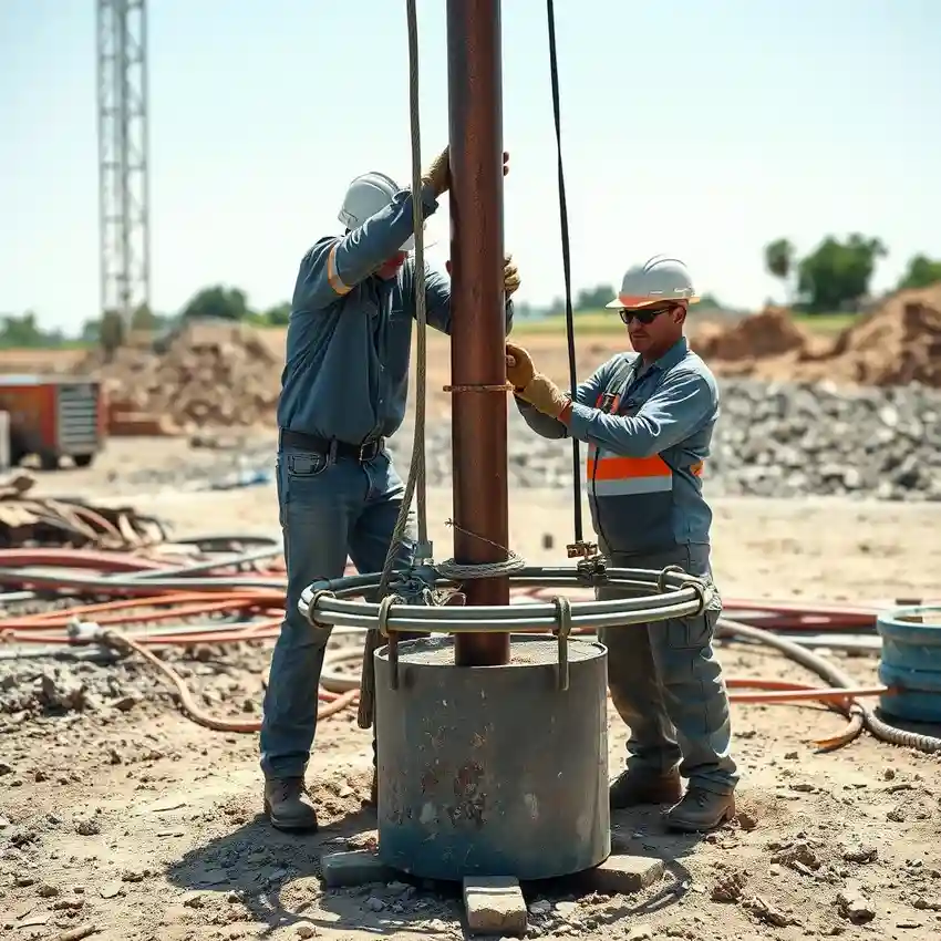
Our approach in Montgomery begins with a comprehensive site evaluation to understand the subsurface conditions. This informs the strategic planning of the water well drilling operation. We select drilling techniques—whether rotary, percussion, or sonic—based on the anticipated soil and rock strata. Throughout the process, we meticulously log geological formations and monitor drilling parameters. The final step involves well development to ensure optimal aquifer connection and water clarity, followed by yield testing to confirm the sustainable capacity of the well for the client's needs.
Reference Technical Parameters
| Parameter | Reference Value |
|---|---|
| Predominant Soil Type | Clay, Sand, and Gravel sequences |
| Typical Groundwater Level | 20 - 100 ft below surface |
| Bedrock Depth (Chalk/Limestone) | 100 - 300 ft |
| Maximum Seismic Acceleration (PGA) | Site-specific, per USGS maps |
| Typical SPT N60 Value Range | Variable, 5-30 blows/ft in common soils |
Local Considerations — Montgomery Alabama
1. **Geology & Aquifers**: Montgomery sits on the Gulf Coastal Plain, with water-bearing sands and gravels of the Miocene and Eocene ages overlaying chalk and limestone. The principal aquifers are the Miocene-Pliocene sediments and the deeper Clayton aquifer. 2. **Groundwater Depth**: Water levels are generally shallow, often between 20 to 100 feet, but can vary significantly with local topography and seasonal recharge. 3. **Seismic Context**: While seismic risk is moderate compared to the West Coast, site-specific evaluation is prudent. 4. **Neighborhood Contrast**: Areas near the Alabama River floodplain may have very shallow water tables and softer sediments, while upland areas may require drilling into more consolidated materials. 5. **Typical Cases**: A frequent challenge is navigating layers of dense clay and sand to reach the productive aquifer zones, a process where a preliminary hydrogeological survey is invaluable. For major regional projects, our primary operations hub provides extensive support for water well drilling services from our Atlanta team.
Request a Quote
Our team reviews your project and issues an initial report at no cost.
Or write us directly at [email protected]
Services in Montgomery Alabama
Applicable Standards
- Alabama Department of Environmental Management (ADEM) Regulations
- Local County Well Construction Codes
- Safe Drinking Water Act (SDWA) Standards
Frequently Asked Questions
What are the common soil and aquifer challenges for water well drilling in Montgomery?
The primary challenge is the heterogeneous layering of clays, sands, and gravels typical of the Coastal Plain. These layers can vary greatly in thickness and permeability over short distances. Successfully targeting the productive sand and gravel aquifers requires precise identification of these strata to avoid drilling into low-yield clay layers or mineralized water zones.
Are there specific seismic design considerations for wells in this area?
While not in a high seismic zone like the West Coast, Montgomery is subject to seismic events. General prudent practice involves ensuring proper well casing grouting and securing of surface equipment. For critical infrastructure, a site-specific seismic hazard evaluation may be recommended to inform design details.
Is a hydrogeological study mandatory before drilling a water well in Montgomery?
While not always mandated by code for every single-family residential well, it is a critical best practice. A professional study defines the aquifer depth, expected yield, and water quality, and is essential for designing an efficient, long-lasting well. It is a required step for commercial, agricultural, or municipal-scale projects to obtain necessary permits from ADEM.