Methodology
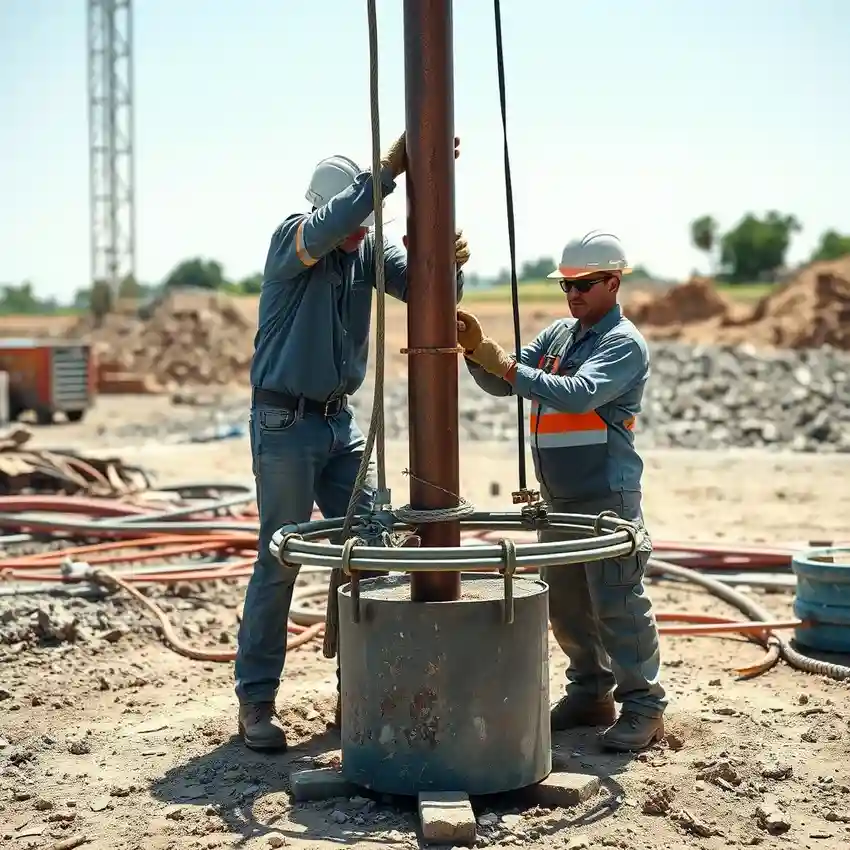
Our approach in Memphis begins with a thorough evaluation of site-specific conditions, integrating regional aquifer data with local subsurface information. We prioritize understanding the depth to the Memphis Sand Aquifer and the protective clay layers above it. This foundational knowledge guides our entire water well drilling process, from selecting the optimal drilling method to designing a well that maximizes yield while protecting the aquifer's integrity. We employ techniques suited to the unconsolidated sands and clays, ensuring a properly constructed and developed well.
Reference Technical Parameters
| Parameter | Reference Value |
|---|---|
| Predominant Soil Type | Unconsolidated Sands and Clays (Mississippi Embayment) |
| Bedrock Depth (Paleozoic) | 900 - 1,500 ft below surface |
| Typical Aquifer Depth (Memphis Sand) | 350 - 1,100 ft below surface |
| Maximum Seismic Acceleration (PGA) | 0.2g - 0.4g (New Madrid Zone) |
| Typical Groundwater Level | Shallow to Artesian (confined aquifer conditions) |
Local Considerations — Memphis
1. **Geology & Aquifer**: The primary source is the high-yield Memphis Sand Aquifer, confined by thick clay layers. Drilling must penetrate these clays to reach the productive sands. 2. **Groundwater Level**: Water levels are generally shallow but can vary. A pre-drilling hydrogeological survey is crucial to confirm depth and artesian pressure potential. 3. **Seismic Context**: Located in the New Madrid Seismic Zone, well construction must consider liquefaction potential in sandy soils. 4. **Urban vs. Rural Contrast**: In urban areas, well placement must account for existing infrastructure and potential anthropogenic contaminants, while rural sites offer more flexibility but require careful siting. 5. **Typical Cases**: We frequently address scenarios like tapping the aquifer for irrigation in outlying counties or providing supplemental water for industrial use within the city. For major regional operations, our primary hub coordinates extensive projects, including comprehensive water well drilling services from our Atlanta team.
Request a Quote
Our team reviews your project and issues an initial report at no cost.
Or write us directly at [email protected]
Services in Memphis
Applicable Standards
- Tennessee Department of Environment & Conservation (TDEC) Rules
- Shelby County Health Department Regulations
- Well Construction Standards per local codes
Frequently Asked Questions
Why is soil and aquifer analysis so important for a well in Memphis?
While the Memphis Sand Aquifer is extensive, its depth, thickness, and water quality can vary locally. The overlying clay confining units are critical to protect the aquifer from surface contamination. Proper analysis ensures the well is screened in the optimal sand layer and constructed to prevent the migration of poor-quality water from other strata, guaranteeing a sustainable and safe water supply.
How does Memphis's location in a seismic zone affect well drilling?
The New Madrid Seismic Zone presents a liquefaction risk, particularly in saturated sandy soils. Our well design and construction methods account for this by ensuring proper well casing integrity and grouting to prevent well collapse or aquifer contamination during seismic activity, adhering to prudent engineering practices for the region.
Are permits and specific studies mandatory before drilling a water well in Shelby County?
Yes. A permit from the Shelby County Health Department is required. While not always mandating a full consultant's report for simple residential wells, the permitting process requires details on proposed well construction and location. For commercial, industrial, or agricultural wells, a professional hydrogeological evaluation is typically necessary to obtain approval and ensure regulatory compliance.