Methodology
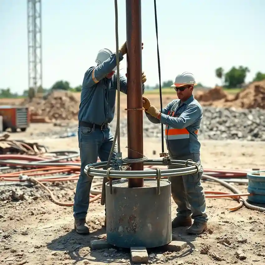
Our methodology for water well drilling in Laredo begins with a comprehensive assessment of available geological data and local well logs. We then conduct a field reconnaissance to identify the optimal drilling location, considering factors like accessibility and proximity to potential contaminants. The actual water well drilling process employs rotary or percussion techniques suited to the encountered formations—typically sand, clay, and caliche. We continuously log drilling parameters and collect cuttings for analysis. Upon reaching the target aquifer, the well is properly cased, grouted, and developed through surging and pumping to remove fine sediments and maximize the well's specific capacity and longevity.
Reference Technical Parameters
| Parameter | Reference Value |
|---|---|
| Predominant Soil Type | Clay, Sand, Caliche |
| Typical Groundwater Level | 50 - 200 ft below surface |
| Bedrock Depth (Escondido Formation) | 300 - 600 ft |
| Maximum Seismic Acceleration (PGA) | Low (Zone 0 per IBC) |
Local Considerations — Laredo
1. **Geology & Aquifers**: Primary water supply comes from the shallow Gulf Coast Aquifer System, with yields highly dependent on the local saturation and permeability of sand layers within the Laredo and Jackson formations. 2. **Water Table Depth**: The depth to groundwater is variable, generally ranging from 50 to 200 feet, but is subject to seasonal fluctuation and long-term trends. 3. **Seismic Context**: While not a high seismic zone, local building practices consider soil stability. 4. **Neighborhood Contrast**: As noted, well performance differs between northwestern and southeastern Laredo due to geological changes. 5. **Typical Cases**: Successful projects often hinge on accurately identifying the most productive sand stratum and ensuring a proper pump installation matched to the well's characteristics and the user's demand. For complex regional aquifer projects, our team often coordinates with our primary hub for comprehensive water well drilling services from Houston.
Request a Quote
Our team reviews your project and issues an initial report at no cost.
Or write us directly at [email protected]
Services in Laredo
Applicable Standards
- Texas Administrative Code (TAC) Chapter 290
- Texas Water Development Board (TWDB) Guidelines
- Webb County Local Regulations
Frequently Asked Questions
What type of soil conditions are most common for water well drilling in Laredo?
Laredo's subsurface is characterized by interbedded layers of clay, sand, and caliche (calcium carbonate). The sand layers within the Laredo Formation are the primary water-bearing zones. The presence and thickness of these productive sands are key determinants of well yield and directly influence the drilling and development techniques we employ.
Are there specific seismic regulations that affect well construction in Laredo?
Laredo is located in a region of low seismicity, classified as Seismic Zone 0 in the International Building Code. While seismic design is not a primary driver for residential well construction here, all our well casing and sealing practices adhere to the stringent standards set by the Texas Administrative Code to ensure structural integrity and protect the aquifer from surface contamination.
Is a hydrogeological study mandatory before drilling a water well on my property?
While not always mandated by local ordinance for single-family residences, a professional hydrogeological survey is highly recommended. It is critical for identifying the best drilling location, estimating potential yield, and ensuring the well is properly constructed to avoid interference with neighboring wells or contamination sources. For commercial, industrial, or agricultural uses, such studies are often a regulatory or practical necessity.