Methodology
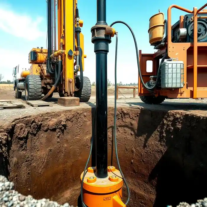
Our approach in Glendale begins with a comprehensive site evaluation, integrating historical well data, geological maps, and topographic analysis to understand subsurface conditions. This foundational work informs the strategic planning of the water well drilling operation. We select drilling techniques—whether rotary, cable tool, or sonic—based on the anticipated geology, from unconsolidated alluvium to hard Franciscan formation rock. Throughout the process, we conduct real-time logging and sampling to confirm aquifer locations and water quality, culminating in a systematic well development and test pumping phase to validate sustainable yield.
Reference Technical Parameters
| Parameter | Reference Value |
|---|---|
| Predominant Soil Type | Alluvial Fan Deposits (Sandy Loam to Clayey Sand) |
| Maximum Seismic Acceleration (PGA) | 0.4g - 0.6g (Seismic Zone 4, per CEC) |
| Typical Groundwater Level Depth | 50 - 200 feet below ground surface |
| Bedrock Depth (Franciscan Formation) | Highly Variable (Surface in foothills to 100+ ft in basin) |
| Typical Standard Penetration Test (SPT) N60 Value | 10 - 50 blows/ft (variable with depth and location) |
Local Considerations — Glendale California
Glendale's geology is characterized by alluvial fan deposits from the Verdugo Mountains meeting older alluvium of the Los Angeles Basin, creating variable permeability. Groundwater levels are generally deep, influenced by regional use and drought cycles, requiring careful assessment. High seismic activity mandates well construction designs that account for liquefaction potential in sandy zones and ground shaking. Conditions differ significantly between the flatlands near the 134 Freeway and the rocky foothills, impacting drilling methods and costs. A typical project involves navigating these layers to target a sustainable aquifer while ensuring casing and grouting protocols meet seismic resilience standards, a process where a detailed hydrogeological survey is critical. For broader regional expertise, our team also provides comprehensive water well drilling services across the Los Angeles basin.
Request a Quote
Our team reviews your project and issues an initial report at no cost.
Or write us directly at [email protected]
Services in Glendale California
Applicable Standards
- California Water Code
- Glendale Municipal Code
- California Building Code (CBC) Seismic Provisions
- Los Angeles Regional Water Quality Control Board Regulations
Frequently Asked Questions
What are the main soil and rock challenges for drilling a water well in Glendale?
The primary challenges include heterogeneous alluvial deposits with interbedded sands, silts, and clays, which can cause caving during drilling. In the foothills, encountering hard, fractured Franciscan complex bedrock requires appropriate drilling equipment. Additionally, the presence of cobbles and boulders in alluvial fans can damage drill bits and slow progress, necessitating experienced operational judgment.
How does Glendale's high seismicity influence well construction?
Seismic design is integral. Well casings must be grouted securely to prevent collapse or contamination during ground shaking. The selection of casing materials and the design of the well seal must account for potential liquefaction in saturated granular soils, ensuring the well's structural integrity and water quality are maintained after a seismic event as per California Building Code standards.
Is a hydrogeological study mandatory before drilling a well in Glendale?
While not always mandated by the city for single-family residential wells on large lots, a professional hydrogeological study is highly recommended and is often required by the Los Angeles Regional Water Quality Control Board for larger extraction volumes. It is essential for identifying the appropriate aquifer, estimating sustainable yield, and ensuring the well does not adversely impact neighboring wells or water rights, forming the basis for a successful permit application.