Methodology
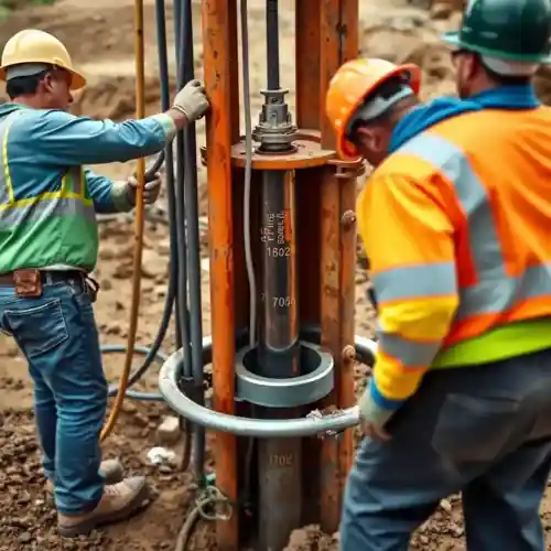
Our methodology for projects in Dallas begins with a comprehensive site evaluation to understand the local stratigraphy, targeting the most productive zones within the Trinity or Woodbine aquifers. We then proceed with the drilling phase, employing techniques suited to the alternating layers of limestone, sandstone, and shale. Critical to this process is a thorough hydrogeological survey to accurately characterize the aquifer's properties. The well is then properly constructed, developed to remove fine sediments, and tested to determine its sustainable yield and water quality, ensuring long-term performance.
Reference Technical Parameters
| Parameter | Reference Value |
|---|---|
| Predominant Soil Type | Clay, Clay Loam, and Sandy Loam |
| Typical Groundwater Level (ft BGS) | 50 - 400 ft (variable by aquifer) |
| Bedrock Depth (ft BGS) | 20 - 100 ft (Austin Chalk formation) |
| Maximum Seismic Acceleration (PGA) | 0.05g - 0.10g (Site Class D) |
Local Considerations — Dallas
Dallas presents unique considerations for water well drilling: 1) The geology is characterized by the Cretaceous-age Austin Chalk and Eagle Ford Shale, influencing drilling speed and tool selection. 2) Groundwater levels can vary significantly, with deeper drilling often required in areas of high historical drawdown. 3) While seismic risk is moderate, proper well construction accounts for soil stability. 4) Contrasts exist between the sandy soils of eastern Dallas County and the clay-rich areas to the west, impacting infiltration and potential yield. 5) A common challenge is navigating the permitting process with the Texas Commission on Environmental Quality (TCEQ) and local groundwater conservation districts, which is why professional pump installation and reporting are crucial for compliance. For major regional operations, learn about our water well drilling services from our Houston hub.
Request a Quote
Our team reviews your project and issues an initial report at no cost.
Or write us directly at [email protected]
Services in Dallas
Applicable Standards
- Texas Administrative Code, Title 30, Chapter 290 (Public Drinking Water)
- Texas Water Code, Chapter 36 (Groundwater Conservation Districts)
- Local Rules of North Texas Groundwater Conservation District
Frequently Asked Questions
What soil and geological conditions are most common for drilling a water well in Dallas?
The Dallas area primarily features surficial soils of clay and clay loam overlying Cretaceous sedimentary rock, including the Austin Chalk and Eagle Ford Shale. Drilling typically penetrates these layers to reach the water-bearing sands and fractures of the Trinity Aquifer. The presence of hard rock strata requires robust drilling equipment and can influence the well's construction design and cost.
Are there specific seismic design considerations for water wells in Dallas?
While not in a high seismic zone like coastal areas, Dallas is subject to occasional seismic activity. Well design considerations focus more on the structural integrity of the casing through unstable clay layers and ensuring a proper sanitary seal to prevent surface contamination, rather than on specific seismic loading calculations typically required for building foundations.
Is a hydrogeological study mandatory before drilling a water well in Dallas?
While not always mandated by law for single residential wells, a professional hydrogeological study is highly recommended and is often required by local groundwater conservation districts for commercial or high-yield wells. It is essential for determining the optimal location, depth, and expected yield, and is a critical part of the permit application process with the TCEQ or local district.