Methodology
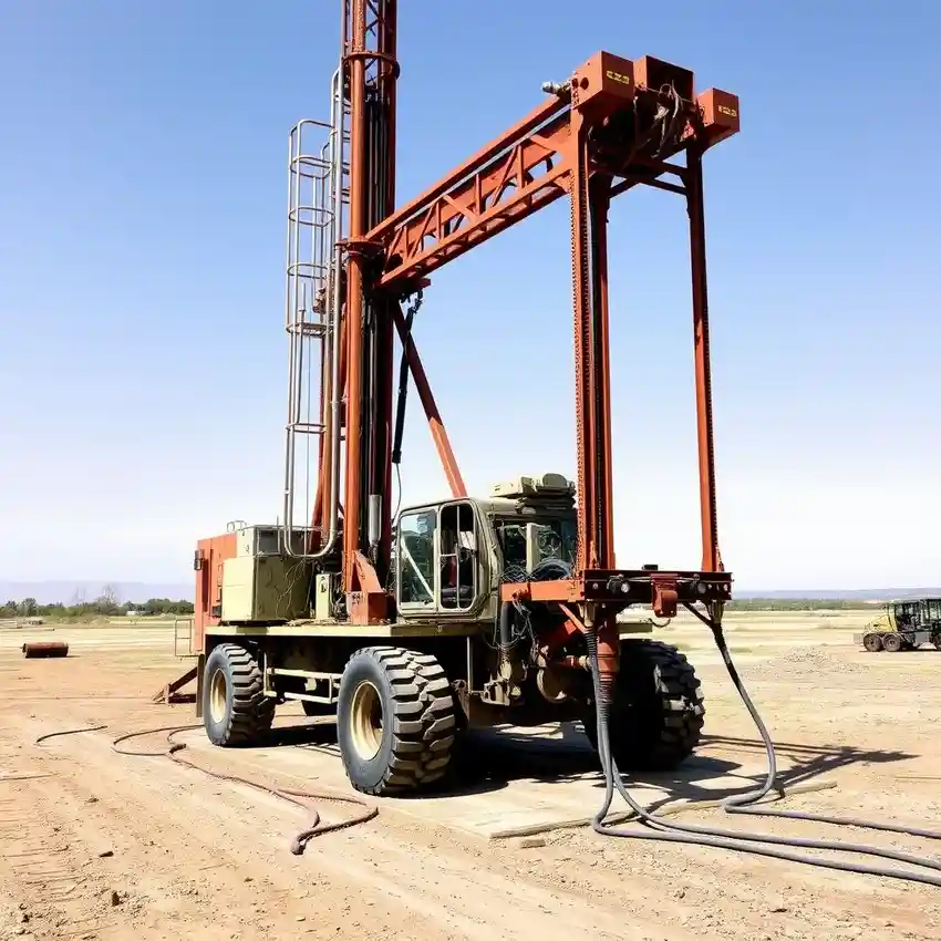
Our methodology for projects in Arlington begins with a comprehensive site evaluation to understand the local geology, primarily the Trinity and Woodbine aquifers. We assess historical well data, surface geology, and potential contaminants. This informs the strategic planning of the water well drilling process, where we select appropriate techniques—often rotary or cable tool—based on the expected depth to water-bearing zones and the nature of the overburden and bedrock. We prioritize proper well construction, development, and testing to validate sustainable yield and water quality specific to the Arlington subsurface.
Reference Technical Parameters
| Parameter | Reference Value |
|---|---|
| Predominant Soil Type | Clay, Sand, and Sandy Clay |
| Bedrock Depth (Typical) | 50 - 300 ft below surface |
| Typical Groundwater Level | 100 - 400 ft below surface |
| Maximum Seismic Acceleration (PGA) | 0.10g - 0.15g |
| Typical SPT N60 Value Range | 10 - 40 blows/ft (variable with depth and stratum) |
Local Considerations — Arlington
Arlington's geology is characterized by Cretaceous-age sands, clays, and shales overlying the Trinity Aquifer. Groundwater levels can vary significantly, generally declining from north to south. Seismic activity, while moderate, is a design consideration given the fault structures in the region. Contrasts are notable between areas over the deeper, confined sections of the aquifer versus shallow, unconfined zones, affecting well depth and construction. A typical challenge involves navigating the dense clay layers to reach productive sandstone units, which is why a preliminary hydrogeological survey is critical. For major regional projects, our primary operational hub provides extensive support; learn more about our capabilities through our water well drilling services based in Houston.
Request a Quote
Our team reviews your project and issues an initial report at no cost.
Or write us directly at [email protected]
Services in Arlington
Applicable Standards
- Texas Administrative Code, Title 16, Part 4, Chapter 76 (Water Well Drillers and Pump Installers)
- Texas Water Development Board (TWDB) Guidelines
- Local Arlington Municipal Codes
- EPA Underground Injection Control (UIC) Regulations
Frequently Asked Questions
What soil and rock conditions are typical for water well drilling in Arlington?
Arlington primarily sits over sedimentary formations including the Austin Chalk, Eagle Ford Shale, and the Woodbine Group. Drillers commonly encounter layers of dense clay, unconsolidated sand, and fractured shale before reaching the water-bearing sandstone units of the Trinity Aquifer. The variability of these layers necessitates careful drilling technique selection and real-time formation analysis.
Are there specific seismic design considerations for wells in Arlington?
While not in a high seismic zone like coastal areas, Arlington is subject to seismic activity from the Balcones and Ouachita fault zones. Well design, particularly casing selection and grouting procedures, should account for potential ground shaking to ensure structural integrity and prevent aquifer contamination, aligning with prudent engineering practice for infrastructure.
Is a professional hydrogeological study mandatory before drilling a well in Arlington?
While not always mandated by code for every single-family residential well, a professional study is highly recommended and often required for commercial, municipal, or irrigation wells. It is essential for determining optimal location, depth, yield, and for securing any necessary permits from the Texas Department of Licensing and Regulation (TDLR) and local groundwater conservation districts.